Design and implementation of indoor positioning navigator
1.1 Project Summary
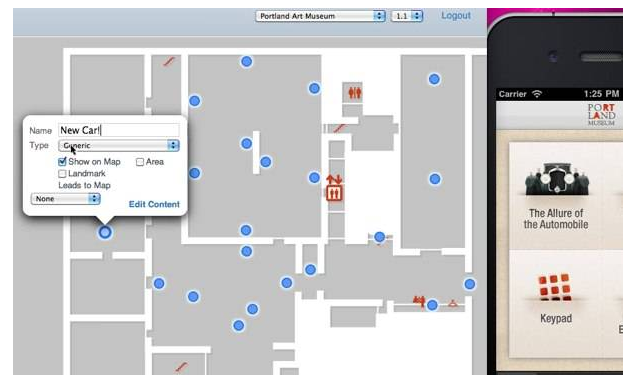
At present, in some large shopping malls or venues, there are only floor plans for indoor venues, but for most people, it is not easy to find a convenient and fast route to the destination through the floor plan in a short time. Based on the iNEMO platform provided by STMicroelectronics, this solution has designed a more user-friendly, more convenient and convenient multi-function navigator for large indoor venues. The navigator mainly has functions of positioning, calibration, navigation, etc. The main realization is to measure the angular velocity by the three-axis gyroscope on the STEVAL-MK1062V2 experiment board to determine the direction, determine the displacement through the linear acceleration sensor of the geomagnetic module, pass the temperature sensor and the air pressure. The sensor reads the data, transmits the data via Wi-Fi, and finally calculates it through the Android smartphone and displays the result. Compared with the floor plan, the navigator can provide users with more personalized, more convenient and simple cross-floor positioning navigation services.
1.2 Project Background / Motivation
At present, more and more large-scale shopping malls or venues are being built, including a wide range of clothing brands, restaurants, video games, movies, and other shopping and entertainment venues, and special occasions... all of which attract customers. It also leads to some of the more common problems in the mall:
How to find a convenient and convenient way to reach your destination without going through the floor plan?
How to achieve the shortest time and shortest path between different floors?
If you lose with your partner, how can you find the other party in the shortest possible time?
In the event of an emergency, how to escape the scene as quickly and efficiently as possible?
Undoubtedly, in this type of place, how to quickly locate navigation is a very important issue for customers. Even with the existence of a plan, it is still necessary to go through a series of analyses to draw conclusions. If you also consider cross-floor issues, you also need to consider the time and speed of the cross-floor approach. From this we hope to have a more "smart" navigation tool to guide us to the destination faster and more convenient. The navigator provides customers with more precise directions and distances, providing an optimal way to reduce the time spent on positioning navigation.
In the choice of computing terminal and display module, we consider using a smart phone as the terminal of this project, and select a smart phone with android development platform. The smart phone has the characteristics of portability, fast computing speed, beautiful appearance, convenient development, and a large number of people, which facilitates the processing of sensor data and the promotion of software. And the data at the beginning of 2011 showed that Android, which has only been officially listed for two years, has surpassed the Saipan system that has dominated for ten years, making it the most popular smartphone platform in the world.
The advantages of Android are as follows:
Openness: The platform developed allows any mobile terminal vendor to join the Android Alliance. Significant openness allows it to have more developers and help build up popularity.
Breaking away from bondage: Users can connect to the network more easily, and operators' constraints are reduced.
Rich hardware: Due to the openness of Android, many manufacturers will launch a variety of products with unique features and features. Functional differences and features do not affect data synchronization or even software compatibility.
Developer: The Android platform provides third-party developers with a very broad and free environment. Therefore, it will not be obstructed by various rules and regulations.
Google Apps: Android platform phones will seamlessly integrate with great Google services.
Based on the above considerations, we decided to process the data and display the effect on the android platform. At the same time, we hope to expand some of the features such as speech recognition, audio prompts and so on similar to the "guide dog" function.
Second, the demand analysis2.1 Functional requirements
1. Collect current environmental information in real time to meet users' needs for understanding the current environment.
2. Real-time collection of user's speed information for updating the user's location status.
3. It is possible to store and update the map, and guide the user's direction of travel according to the user's location and destination information.
4. Realize the endpoint-to-point Wi-Fi communication between the experiment board and the Android smartphone to ensure that the collected information can be transmitted to the mobile phone end in time.
5. A good display module that allows all kinds of information to be displayed in an orderly manner on the Android platform.
6. Correction function to perform reference position recognition to improve positioning accuracy.
2.2 Performance standards
1. The detection error for ambient temperature does not exceed 0.5°.
2. The measurement speed is accurate, and finally the recognition of the user's position is no more than 10m at the distance correction point of 200m.
3. The identification of roads and driving directions is accurate and effective when navigating.
4. Accurate and effective identification of roads and directions of travel when navigating stairs and elevators. Identification.
5. It can identify the complex environment in the building when navigating, and can intelligently select roads when there are different roads.
6. There is no obvious delay in real-time location display on the mobile phone.
Titanium Glasses,Titanium Eyeglass Frames,Titanium Eyewear,Titanium Eyeglasses
Danyang Hengshi Optical Glasses Co., Ltd. , https://www.hengshi-optical.com